Introducing GravitasEDGE
The advent of digital transformation using the cloud has created a unique opportunity to build a new generation of operations geology software for the rig of the future, improving collaboration and productivity. GravitasEDGE has been designed using the latest technology, with users accessing a rich operations geology toolset to manage the geological workflow which seamlessly integrates with other disciplines such as drilling and asset geoscience.
World leading applications Winlog, EZ-Correlate, PoreView and Reporter are provided for log visualization and analysis, well correlation, pore pressure monitoring and daily and end of well reporting. The GravitasEDGE Mobile App has been engineered for phones and tablets, allowing users to view charts and reports on any device, anytime, anywhere.
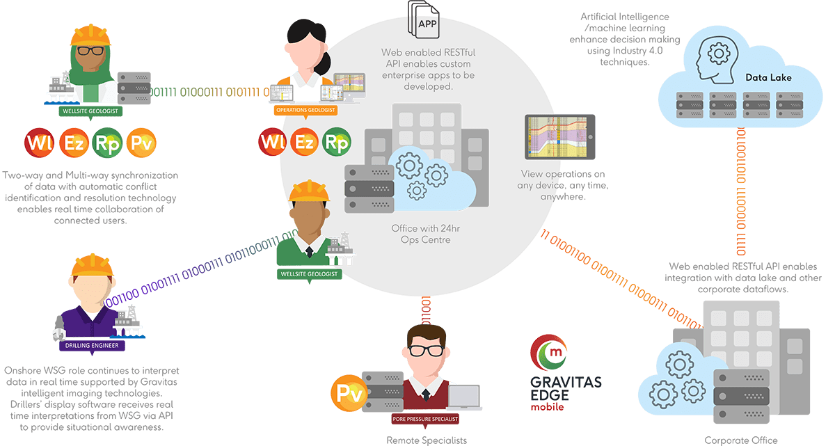
Our microservices based solution allows clients to integrate and orchestrate their workflows throughout the well lifecycle, from planning to abandonment, using the industry’s first API for operational geoscience. Clients who adopt our new technology stack can use our DataBridge to connect users on rigs, offices and homes throughout the world to create a globally distributed interpretation platform, even when working with intermittent communication links.
IT departments can geolocate data seamlessly around the world ensuring performant access for users on their private cloud.
GravitasEDGE provides a comprehensive solution to plan, drill, monitor and report all types of wells, whilst removing data silos, liberating operational data and enabling machine learning.
What's New
Complete Solution: Our industry-leading software applications combine to provide a powerful interactive toolbox for the user to visualize wells, analyze well data and manage operations. Log Drawing, multi-well correlation, pore pressure monitoring and automated reporting direct to Microsoft Word are fully integrated. Designed on an ‘enter data once, use many times’ philosophy, all applications within the GravitasEDGE Suite reference a single data source, reducing the effort required to analyze data and create/QC logs, charts, and reports throughout the entire well lifecycle.
GravitasEDGE
Platform
Effortless Deployment
and Management
GravitasEDGE
Data Bridge
Intelligent Data
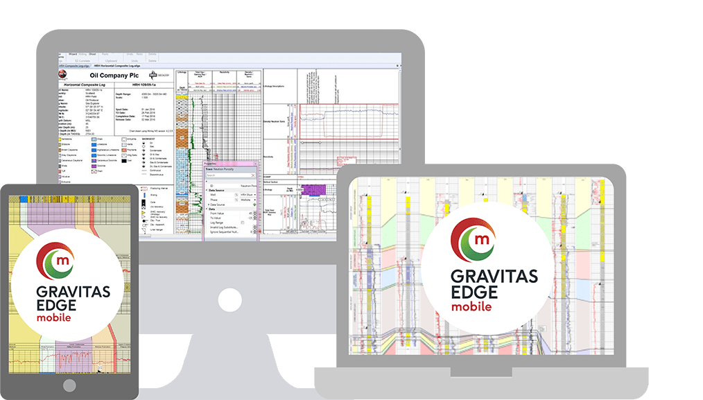
Collaborate on Any Device, Anytime, Anywhere

GravitasEDGE
365
API Integration
Flexible Pricing
Global Usage
GravitasEDGE transforms operational geoscience using the cloud
- Analyze and monitor wells throughout the lifecycle from planning to abandonment
- Customize logs and charts with LogScript™ to support operational decisions and field data collection needs
- Digital operational correlation of offset wells
- Author operational reports with unified Winlog™ graphics directly into Microsoft® Word™
- Integrate pore pressure monitoring with PoreView™
- View live charts and reports on any device with GravitasEDGE™ mobile
- Enable multi-user, multi-well. real-time workflows with the GravitasEDGE platform in the cloud
- Connect your rig through the DataBridge
-
Manage and report wells at the rig, office or home.
Anytime, anywhere and on any device - Use the cloud to administer and manage GravitasEDGE installations worldwide
- Unrestricted global usage
- First open API for operations geoscience
- Integrate geological and drilling data
- Collaborate through the cloud
- Connect your whole Enterprise with GravitasEDGE platform
How It Works
Packages and Pricing
A modern, flexible solution requires modern, flexible pricing. GravitasEDGE is available with no upfront license fees and no maintenance and support package. Instead, we offer a simple annual access fee which includes support services, software consultancy and online training.
Standalone
Stand Alone
Enterprise
Enterprise
Transform your data workflows with your geologist in the cloud

